Harbour Tides and Currents
|
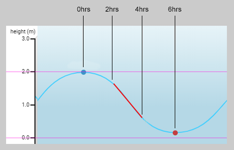
There are approximately 6 hours between high and low tide.
When the water is at it's highest point (blue dot on the chart), or lowest point (red dot on the chart), there will be the least amount of current, this is called a slack tide. From 2 hours after slack tide to 2 hours before the next slack tide, the current is usually at its strongest. (red line on the chart) The height of the tide varies during the year, you may have heard of a king tide, spring tide or neap tide. These are caused by the phase of the moon, and the alignment of the Earth, Sun and Moon, causing higher/lower then usual tidal flow. The higher the tide, the more water will flow in/out of the harbour, resulting in stronger currents to contend with. |

Incoming Harbour Tide.
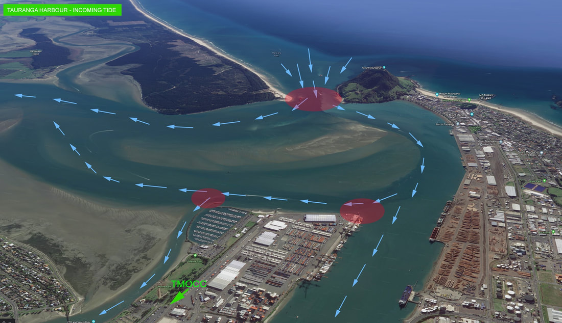
The main flow of water comes in through the Mount entrance, and flows around the sandbar in the middle of the harbour.
The red areas are where the current splits, you can experience rough water conditions in those areas.
The main flow of water comes in through the Mount entrance, and flows around the sandbar in the middle of the harbour.
The red areas are where the current splits, you can experience rough water conditions in those areas.
Outgoing Harbour Tide.
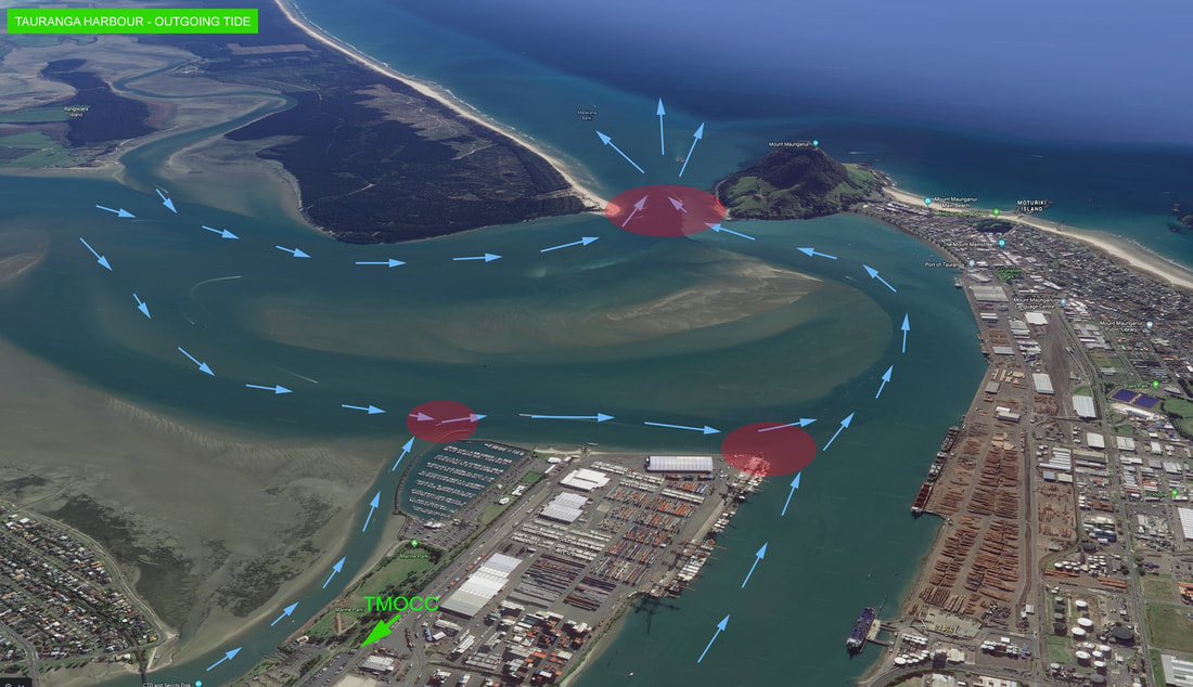
Water flows from Omokora and Te Puna, around the sandbar in the middle of the harbour, and exits though the Mount entrance.
The red areas are where the current converges, you can experience rough water conditions in those areas.
Water flows from Omokora and Te Puna, around the sandbar in the middle of the harbour, and exits though the Mount entrance.
The red areas are where the current converges, you can experience rough water conditions in those areas.


